Crossing the interior of Uzbekistan by bus I got to see steppe and desert, grazing camels and a frenzy of construction.
Some years ago, I’d had the pleasure (is that the right word?) of many long bus journeys across the steppe when I was living in Kazakhstan and visiting other parts of Central Asia. So when I was invited on a work trip to Uzbekistan and found part of the itinerary would involve travelling across the interior of the country from Qarshi to Navoi to Samarkand I could barely contain my excitement.
There are a lot of cliches about the ‘real’ Central Asia. Question: Is trekking the mountains on horseback more ‘real’ than staying in a soviet-era apartment block in an industrial town? I don’t know. And I’m not here to debate what’s ‘real’ and what isn’t. Suffice it to say, crossing the country by bus is real enough for me (especially when I encounter the toilets on the road).
Why travel through Uzbekistan by bus?
What’s the appeal? For me crossing Kazakhstan by bus is what made me appreciate the hugeness and emptiness of the country. It was the small changes in landscape — a change in the colour of the rippling grasses, a rocky outcrop looming out of the flatness, the derelict blocks of an abandoned collective farm. It was travelling from Almaty to the Aral Sea and seeing the agricultural land slowly morph into steppe then into semi-desert where the wind whipped up the sand and half hid the tiny wooden shacks and grazing camels. Now I had the chance to see Uzbekistan by bus too.
I was in Uzbekistan for a conference in Tashkent followed by a tour of various power plants out in the regions. I took the Afrosiab express train as Qarshi (or Karshi), the capital of the capital of Qashqadaryo (or Kashkadarya) region for a visit to a huge gas-to-liquids plant.
From then on all the travel was across Uzbekistan by bus. Qarshi is set in the semi-desert only about 40km from the border with Turkmenistan. Navoi is almost directly due north, but getting there by road requires a zigzag east via Bukhara or west via Samarkand.
Around Bukhara
As we got closer to Bukhara empty countryside was taken over by more and more small towns along the way and strip development by the side of the road — houses, farms, small village, shops even a cotton factory and other industrial plants.
We didn’t actually go through the historic centre of Bukhara, but circled round it, entering Kurgan — the town about 10km from central Bukhara where the railway station is built as bad in the olden days when the railway was built the emir of Bukhara refused to have ‘devil wagons’ coming any closer to his city.
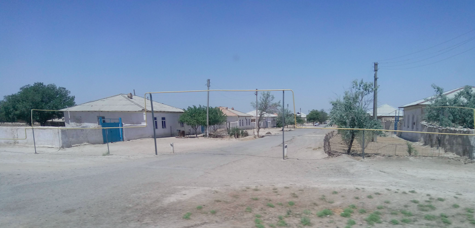
We skirted around Bukhara in where brand new apartment blocks and malls jutted out of the green and fertile oasis. Then it was north towards Navoi. The landscape changed again after Bukhara, with the irrigated fields giving way to empty steppe just dotted with tiny villages.
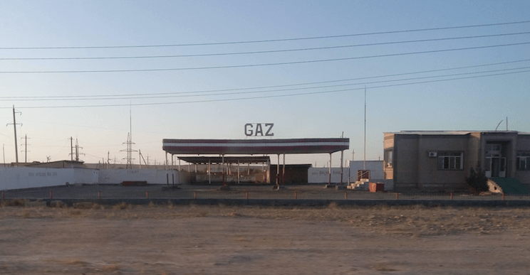
These days a lot of the cars in Uzbekistan run on liquified petroleum gas (LPG) or methane gas, and the many filling stations we passed had ‘GAZ’ or ‘METAN’ in huge letters on their roofs. I remember the shared taxi I was in filling up with gas the second time I went to Tajikistan, and the passengers had to get out and stand behind a wall as the driver told us it was “so dangerous”, but it’s become petty much mainstream now. Even though Uzbekistan has oil, many of the cars have switched to LPG which is cheap and easy to come by.
Red sands and salt
There were fewer settlements or filling stations when we entered the edge of the Kyzylkum (‘red sand’) desert, which is the 15th largest desert in the world with an area of around 298,000 square kilometres. It covers the area between Central Asia’s two great rivers, the Amu Darya and Syr Darya, which used to be called Transoxiana.
We saw small salt plains among the dunes, tinted red in the setting sun. There were also many signs of the extractive industries in the desert which is rich in gold, uranium copper, oil and gas and other natural resources.
It was petty much dark by the time we arrived in the industrial city of Navoi, population around 133,000. The next morning I got up early to explore the centre before we went to visit two nearby power plants, then on to Samarkand, again by bus.

Along the Zerafshan
This was a shorter journey — around three hours compared to the five and a half the previous day — most of it alongside the Zerafshan river, which runs from Tajikistan’s high Zeravshan glacier and enters Uzbekistan close to Samarkand. The name means “spreader of gold” in Persian, because of the gold-bearing sands upstream.
11 years ago I travelled along the higher reaches of the river to Penjikent, Tajikistan, though narrow mountain gorges. Downstream in Uzbekistan the countryside was flatter with the river going life to a swathe of agricultural development and small settlements through the otherwise dry landscape. In fact so much water is taken from the Zeravshan that somewhere past Bukhara it peters out in the desert and never reaches the Amu Darya that it used to feed.
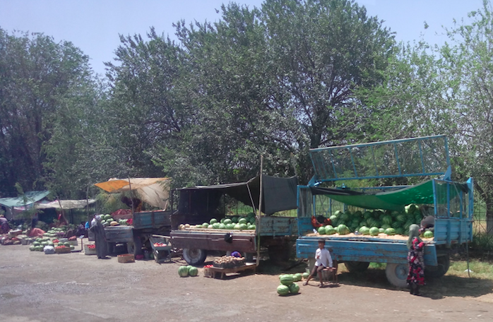
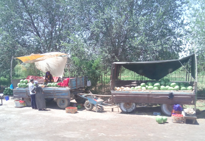
Alongside the farmers harvesting their crops and animals grazing by the roadside, I noticed was the immense amount of construction — not huge developments usually but houses, cafes, hotels, furniture showrooms… Uzbekistan’s population is already by far the largest in Central Asia and is going up by around 600,000 a year.
I wouldn’t have experienced any of this if I’d flown or even whizzed through on an express train, so I was intensely grateful to have had the chance to see Uzbekistan by bus.
More on Central Asia by bus
Here are some of the bus journeys I took across Kazakhstan:
I got behind the controls of a Soviet space rocket at the Baikonur Cosmodrome

Leave a comment