It was a 350km road trip from the Kyrgyz capital Bishkek up to the high mountain of the Naryn region.
We stated the day leaving early from Bishkek, heading east along the main road though the Chui valley, skirting close to the Kazakh border.

The modern day road from Bishkek to Naryn follows the path of one of the northern strands of the old Silk Road, and it’s still the main road from China to Kyrgyzstan.

We passed several huge lorries most likely bringing consumer goods from China to the giant wholesale bazaars in Bishkek that act as a distribution hub for the entire region.

We passed Tokmok, a town of around 70,000 people, where I visited a run-down hospital back in 2004.
The town is right on the Kazakh border, north of the Chui river. Despite being in a historic area, near to the 11th century Burana Tower and the site of the ancient city of Balasagun, it’s a relatively modern town. The Kohand Khanate set up a military post in its northern reaches here in around 1830, but just 30 years later it was destroyed by the Russians. Russian Major-General Mikhail Chernyayev founded the town in 1864.

The road continues to follow the Chui river. The next larger settlement is Kemin, 95km east of Bishkek. Founded in 1912 and with a population of around 10,000, Kemin’s main claim to fame is as the birthplace of Askar Akayev, first president of Kyrgyzstan.
After Kemin the road climbs up into the mountains in which Lake Issyk-Kul is nestled. But rather than driving to Balykhchy on the lake’s western end, we continue due south.
Instead of the stunning lake known as the ‘pearl of the Tian-Shan’ we pass the Orto-Koday reservoir, set among barren rocky hills.

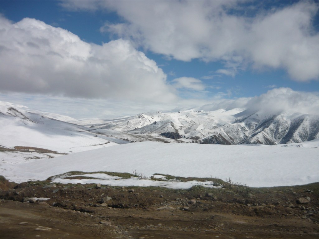
It was getting steadily colder, and there was snow on the higher peaks, and a thin sleet fell on the car in places.
Coming from Almaty where it was still Indian summer, neither my colleague nor I had adequate clothes for the journey from Bishkek to Naryn but we both layered up with all the jumpers and cardigans we had packed.
We stopped in the town of Kochkor, in the northern Naryn region about 45k southwest of Balykhchy.
Naryn is the highest region of Kyrgyzstan, with most of its territory mountains of between 2,000 and 3,000 metres above sea level. We were already high in the Kyrgyz uplands, and Kochkor itself is 1,800 metres high.
Founded in 1909 it’s a mix of a few Soviet blocks and lots of small houses. There’s a well known Saturday livestock market and bazaar, and it’s also a popular tourist centre in the summer, but we were there to interview the mayor.

It was not long after Kyrgyzstan’s second revolution, and the country’s first truly competitive elections were approaching. With dozens of parties competing, election fever had gripped the nation. All along the road from Bishkek to Naryn, in the lowlands and up in the high mountains, party banners were draped across the blue caravans selling drinks and snacks to travellers.

We even saw yurts proclaiming their owners’ political preferences.

The road crosses through the Dolon pass, 3030 metres above sea level, between the Songköl Too and the Bayduluu mountain ranges. The pass is only open between June and October.
It features in My Little Poplar in a Red Headscarf, one of the stories in Kyrgyz author Chingiz Aitmatov’s Tales of the Mountains and Steppes.

When we got to Naryn sleet was falling heavily. The city lies along a picturesque gorge with the Naryn river flowing through it, but that day the mountains barely loomed out of the gloom.
Naryn was the end of the road for us that day. The Chinese border lies beyond the high mountains that surround the city.


Leave a comment